I came across an interesting article in the New York Times on September 10 by Mireya Navarro about area planners contemplating how to strenghten the city to the risk of sea level rise and storms. Clearly everyone in the area knew of the risk to tunnel and subway flooding. It was pointed out that 200,000 people would be flooded by waters that were four feet above present high tide. Eleven percent of streets are within that flood risk zone. Hurricane Irene came just one foot from flooding transportation. In addition, New York is planning to add two million residences in the next 20 years.
Flooding was in the areas predicted by the flood risk maps compiled by Google and made available on the http://architecture.org/ website. Below, I print some of these for interesting areas to us today. Sea level rise is predicted roughly to be between two feet and four feet in the next century, centered around three feet or one meter. A century is a long time to wait or be concerned about, but we must remember that we are building homes today that we expect to last 60 years or longer, and buildings that are expected to last a hundred years. The other thing is that climate change is predicting stronger storms, with apparently the uncanny ability to not wait a hundred years, but to target low lying areas immediately.
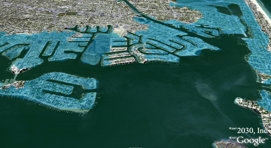
New York City NY for a 3 meter or 9.8 foot flood or sea level rise:

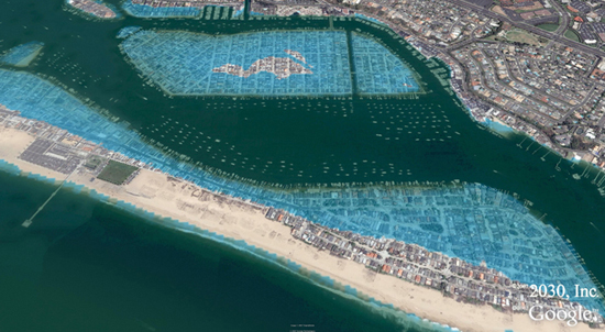
Newport Beach CA for a 1.75 Meter or 5.7 foot Flood:
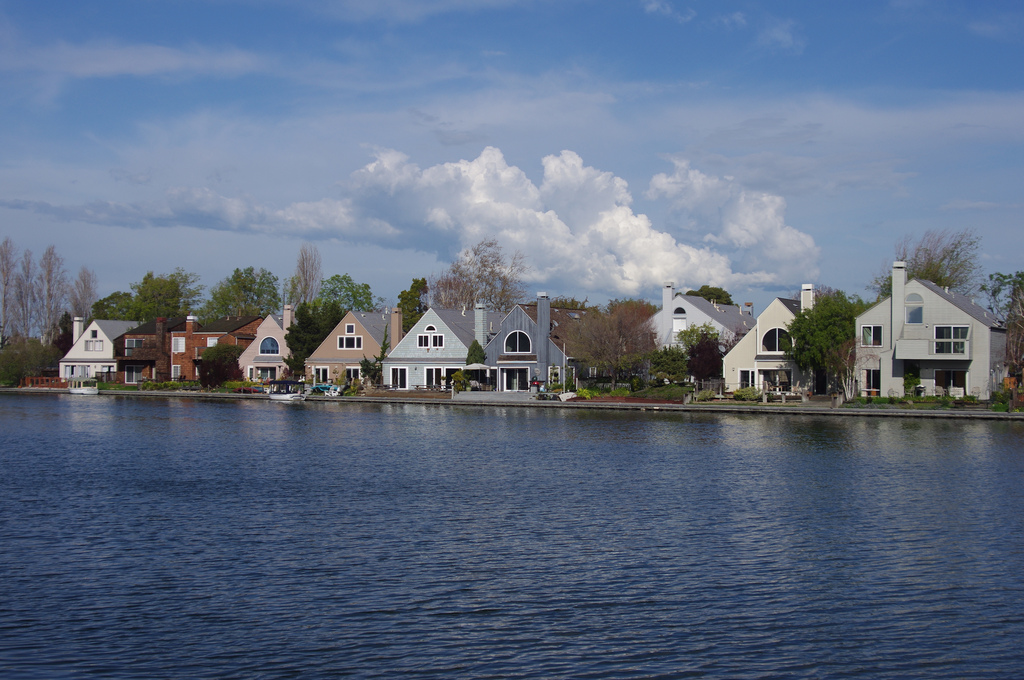
Foster City CA for a 1.25 meter or 4.1 foot flood:

Foster City was created as engineered landfill on bay mud in the 1960s. It is 4 square miles with 30,000 people. It should be pointed out that it is in San Francisco Bay, which has a small opening (Golden Gate), but a large area. For a while, a large ocean storm surge would only slowly raise the height of the bay. Foster City is also listed as a liquefaction zone for earthquakes, but nobody is sure how much the real risk is. It has been listed by Forbes as #10 in the top 25 towns to live well. This picture will give you an idea why it is so idyllic:
Tampa Bay, FL for a 1.5 meter or 4.9 foot flood:
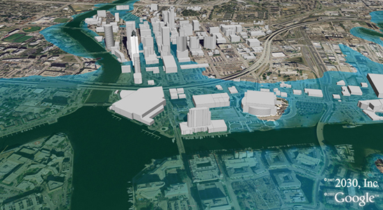
The Tampa Bay Convention Center is the large gray building in the lower left above:

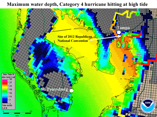
The Tampa Bay one will go down in history since they considered moving the 2012 Republican convention for a week before, due to a possible storm. It is also noted for the presidential nominee saying at the end of his convention speech in the convention center there, that he didn’t care about sea level rise. In a Category 4 hurricane, the convention center would be under 20 feet of water, as occurred to Fort Brooke there in the “Great Gale of 1848”.
Point Pleasant, NJ for a 1 meter or 3.3 foot flood: