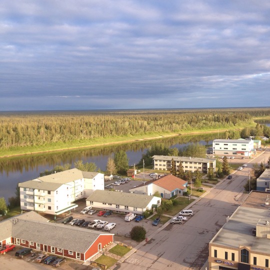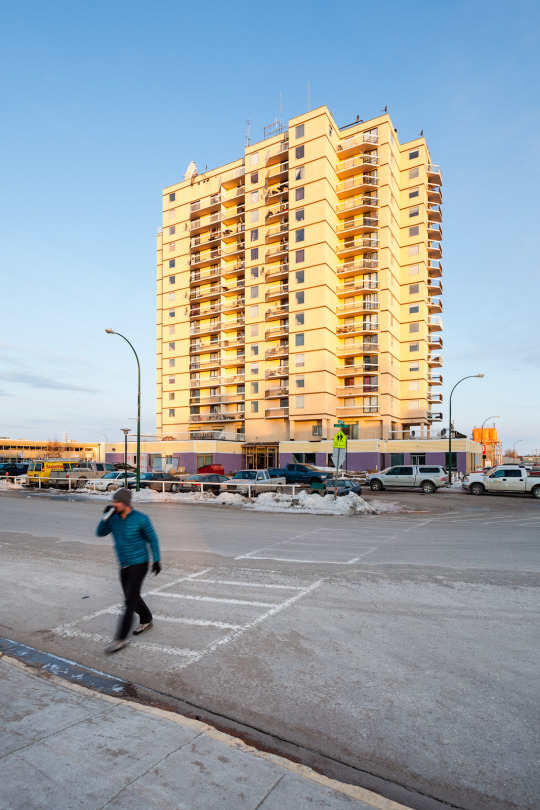
Hello from the top of the High Rise,
We are happy to be back in Hay River. I’m Lindsay Bell, a former NWT teacher turned professor of anthropology. I now live in Syracuse, New York and teach at SUNY, Oswego, the second snowiest campus in the United States. I can’t seem to leave cold and snow behind. I’m here with my collaborator Jesse Colin Jackson. Jesse is an artist and professor at the University of California, Irvine. Together with our research team we are creating a visual story about northern life in larger, semi-urban communities. Our first case study is Hay River.
Hay River is where road, railway and river converge. It is important node in global networks of resource extraction and trade that pre-date the infrastructure it is now known for. The South Slavey Dene people used the mouth of the river as a fish camp, their catch an important currency long before the onset of colonialism. The waterways and bush trails provided the avenues for interregional trade and celebration. We chose Hay River, in part, because it is the community I know best. You can read more about my connection to the community under the BIOS tab.
Our project involves creating a series of images, primarily of the downtown area and the High Rise. You might be asking why? Part of the answer is Jesse (and our other artist collaborator Tori Foster) are experts in making images of urban cities like Toronto, Los Angeles and Beijing. They have a series of techniques that fascinate me. I wondered about what would happen if we tested those techniques in a not-so-conventional urban-ish place like Hay River?
A lot of good research and image-work on the north has focused on remote or rural communities. For some great examples of research by Indigenous scholars see the work of Crystal Fraser and Zoe Todd in the Beaufort Delta and many other community based leaders and researchers across the NWT. In the image department, the most widely circulated pictures are usually of northern lights or snowy landscapes. These are important to the larger portrait of what the north is like. We are hoping to contribute to this picture by focusing on the semi-urban communities that are important nodes in global networks of trade and production as well as the diverse people that call the North home either for a few weeks or for time immemorial.
The project involves creating a series of images, primarily of the downtown area and the High Rise. We are using a set image techniques in combination with my writing to show how internal and external forces (local demands for better infrastructure and the push for/against resource development) leave their mark on communities over time. We are also interested in showing how people experience connections to place in semi-urban communities. The project involves collecting the stories of those who currently live, or have ever lived in the High Rise. In my previous research, I spent a year in the High Rise and collected a number of stories. They are the basis of a book I am writing. The finished images will be shown in art galleries across North America and here in the community.

Why Visualizing Canada’s Urban North? Many Canadians say that they are concerned about the future of the north, but few will ever visit or call the north home. Instead, they rely on media stories, novels, and images to put together an understanding of what it means to call the north home, whether for centuries or even for a short time. National public culture is increasingly visual. Images are snapped and circulated on social media and across different channels faster than ever before. With more people dependent on images to learn about contemporary issues in the north, it is important we have a thoughtful, diverse range of ways of ‘seeing’ the North. We are looking forward to learning how you see it as best we can. We will be posting on this blog page each day as we prepare to collect image-data for the coming year. We are aiming to have our documentation begin on Aboriginal Day, June 21 and run to winter solstice when we return.
