To enable interoperability across organizations, ImageCat and UCI are designing the SWADE ontology. The development of the ontology started from the representation of the drinking/potable water system and the risk analysis task, and will be expanded to the other water infrastructure (stormwater and wastewater) and types of analyses (e.g., water quality). The ontology is modular and contains vocabulary to annotate metadata from an organization and integrate it with external sources, such as for instance, earthquake information from the USGS ShakeMap for near-real time risk analysis.
The SWADE Ontology extends three modules (Smart City, Water Quality, and Measurement) from the Smart Appliances REFerence (SAREF) Ontology published by the European Telecommunications Institute (ETSI) [1]. We introduce two modules: Water Network Infrastructure and Infrastructure Resilience Analysis, as shown in Figure 1.

Water quality: This module contains the SAREF extension for water quality that was developed and published by the European Telecommunications Standards Institute (ETSI)[1]. The module contains all the classes and relationships for managing water quality. For SWADE, we extend the SAREF water quality ontology with two new modules.
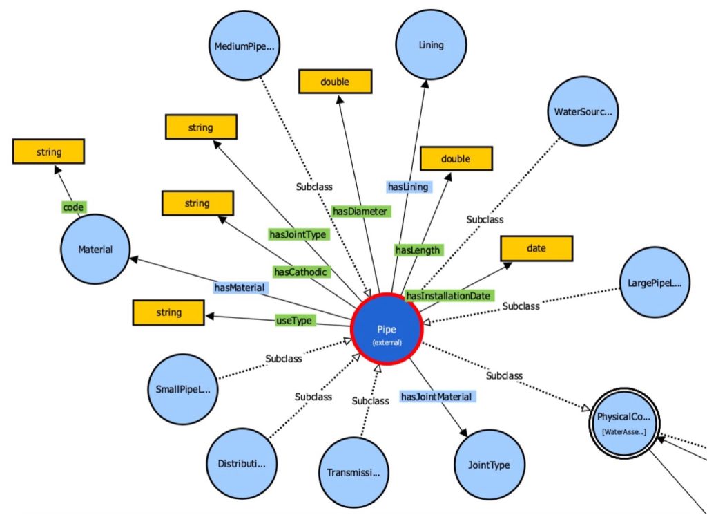
Water network infrastructure: This module was extending the “Pipe” class that already existed in the Water Quality SAREF ontology. The class was extended to include the infrastructure aspect of water pipes, such as different types of water pipes like: water source pipe, distribution pipe, transmission trunk pipe, etc. The class was also developed to have new relationships with the following newly added classes: material, lining, and joint material, as shown in Figure 2. This module was developed with help from industry experts to represent the water network infrastructure with all the necessary concepts for assessing the network resilience to extreme events, such as the characteristics of water pipes, their material, diameter, length, type of joints, etc.
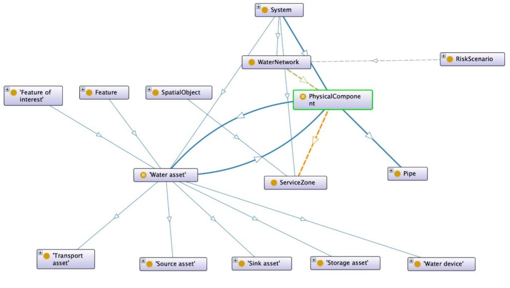
The “System” class in the SAREF ontology was modified to include a subclass called “PhysicalComponent” to connect the water infrastructure classes such as pipe, junction, reservoir, tank, material, lining, etc. with another newly added class called “ServiceZone” as shown in Figure 3. The “ServiceZone” class is a concept that exists in the United States water network that serves various zones within one city; hence, we had to connect the service zone with the SAREF “SpatialObject” class.
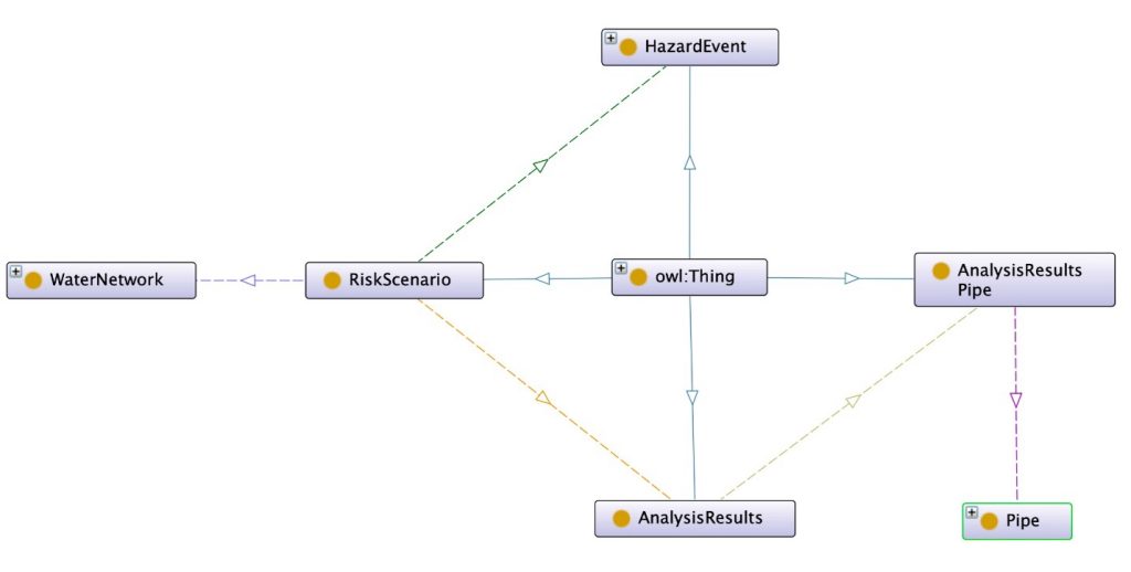
Infrastructure resilience analysis: This module was created to enable cities/agencies to run complex risk analysis queries such as those for earthquakes, flooding, and other disaster events, as shown in Figure 4 and Figure 5. This new module was an extension to the SAREF ontology, and the connection happened through the “WaterNetwork” class that was described earlier. The infrastructure resilience analysis module, along with the SWADE federated query engine, will allow for the simulation of hypothetical natural disaster events in a number of different cities. That, of course, will help cities/agencies evaluate and measure their preparation and response for such events.

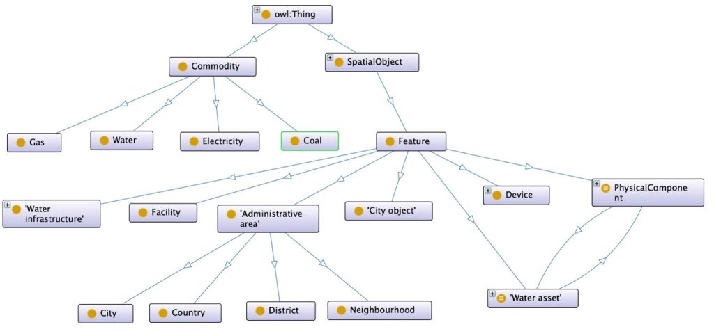
Smart City: This module contains the SAREF extension for the smart city domain, which contains the city’s municipalities and provinces such as city, county, districts, etc. This module is also integrated with devices and measurement ontologies to module various city Key Performance Indicators (KPIs) such as air or water quality [2]. We integrated the city module with the newly developed SWADE modules.
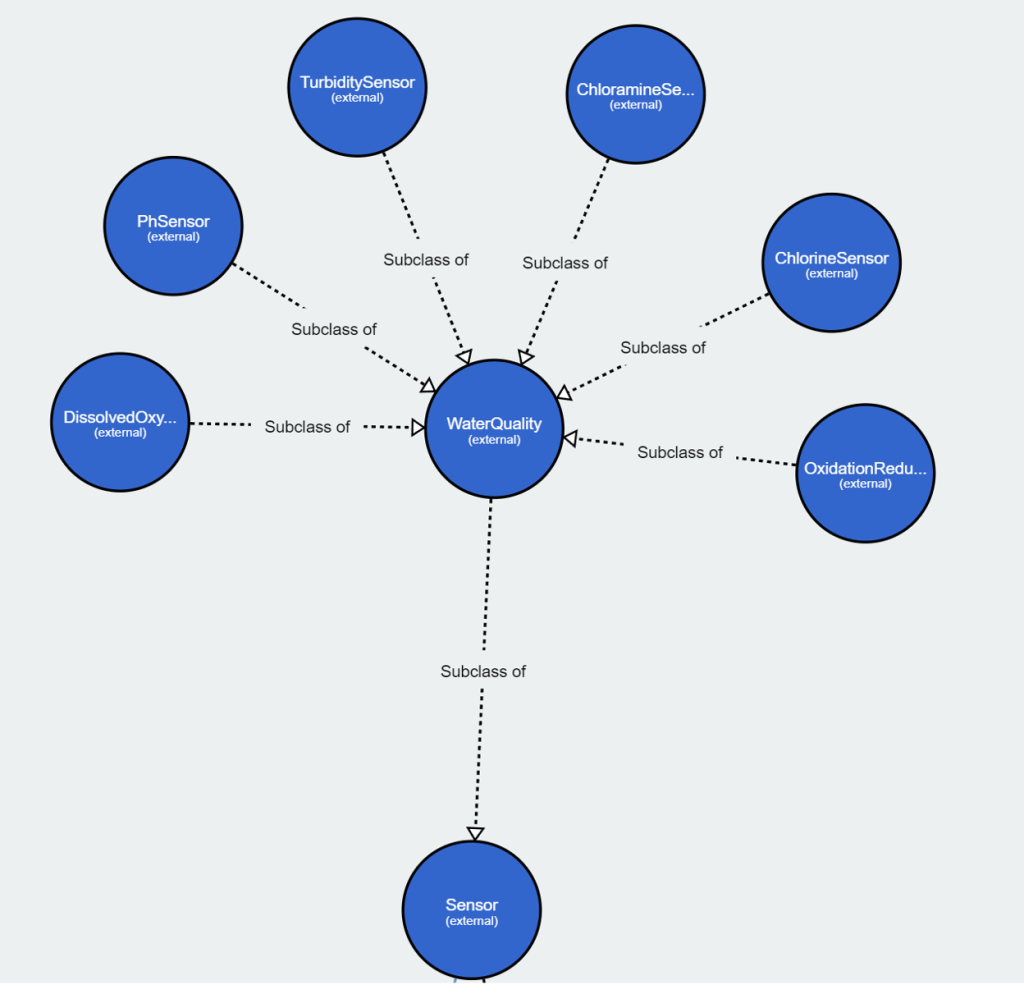
Measurement: The measurement module contains the SAREF extension to measure different temporal intervals for various devices through a predefined device ontology. The IoT water sensors were proposed to be integrated with the water ontology in [3]. Eight distinct water quality metrics have been tracked and measured manually on a daily or weekly basis throughout the USA. These measurements are temperature, turbidity, pH, electrical conductivity, chlorine, chloromine, ORP, and dissolved oxygen. Some of these measurements have been automated thanks to advancements in IoT technologies. As a result, we added sensor names that match these measurement kinds to the sensor class in the SAREF Water Quality module. The sensor class has been expanded to include the “WaterQuality” class and sub-classes of water measurement sensors, as shown in the Figure 9.
References:
[1] Antonio De Nicola and Maria Luisa Villani. Smart city ontologies and their applications: a systematic literature review. Sustainability, 13(10):5578, 2021.
[2] Laura Daniele, Ra´ul Garc´ıa Castro, Maxime Lefran¸cois, and Mar´ıa Poveda- Villal´on. Etsi ts 103 264 v3.1.1 (2020-02): “smartm2m; smart applications; reference ontology and onem2m mapping”. 02 2020
[3] Elem G¨uzel Kalayci, Sebastian Brandt, Diego Calvanese, Vladislav Ryzhikov, Guohui Xiao, and Michael Zakharyaschev. Ontology–based access to temporal data with ontop: A framework proposal. International Journal of Applied Mathematics and Computer Science, 29(1):17–30, 2019.