Flood Height Maps Which May Be Reached with Hurricane Ian
Updated Surge Threat below Thursday 3 PM EST.
Here is the projection for storm surge heights from hurricane Ian on Tuesday, September 27th, 2022. We use the flood maps from coastal.climatecentral.org. Maps are generated for 3, 6, 9 12, and 15 feet where relevant in the projections. There are also high tides of about 2 feet.

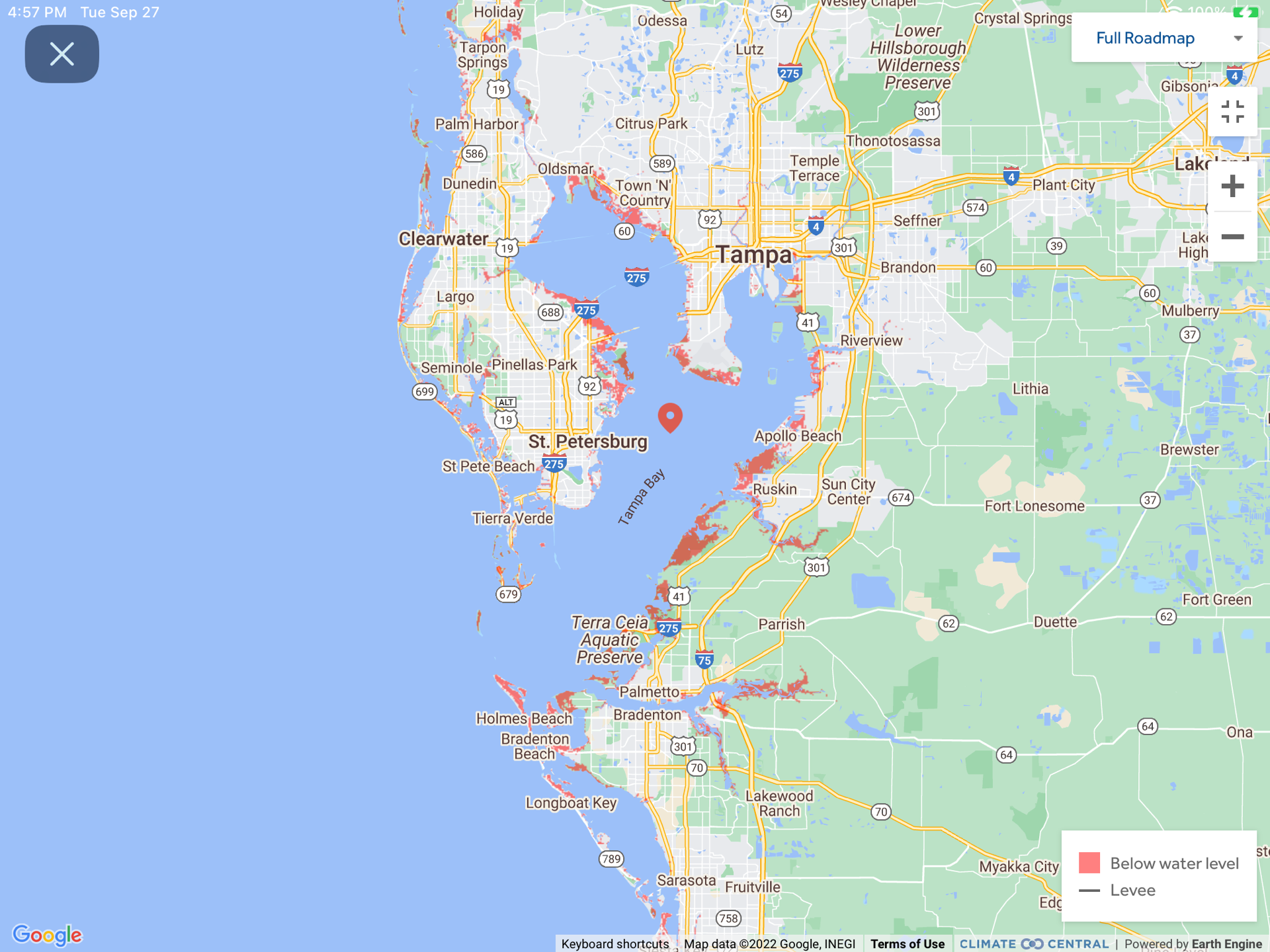
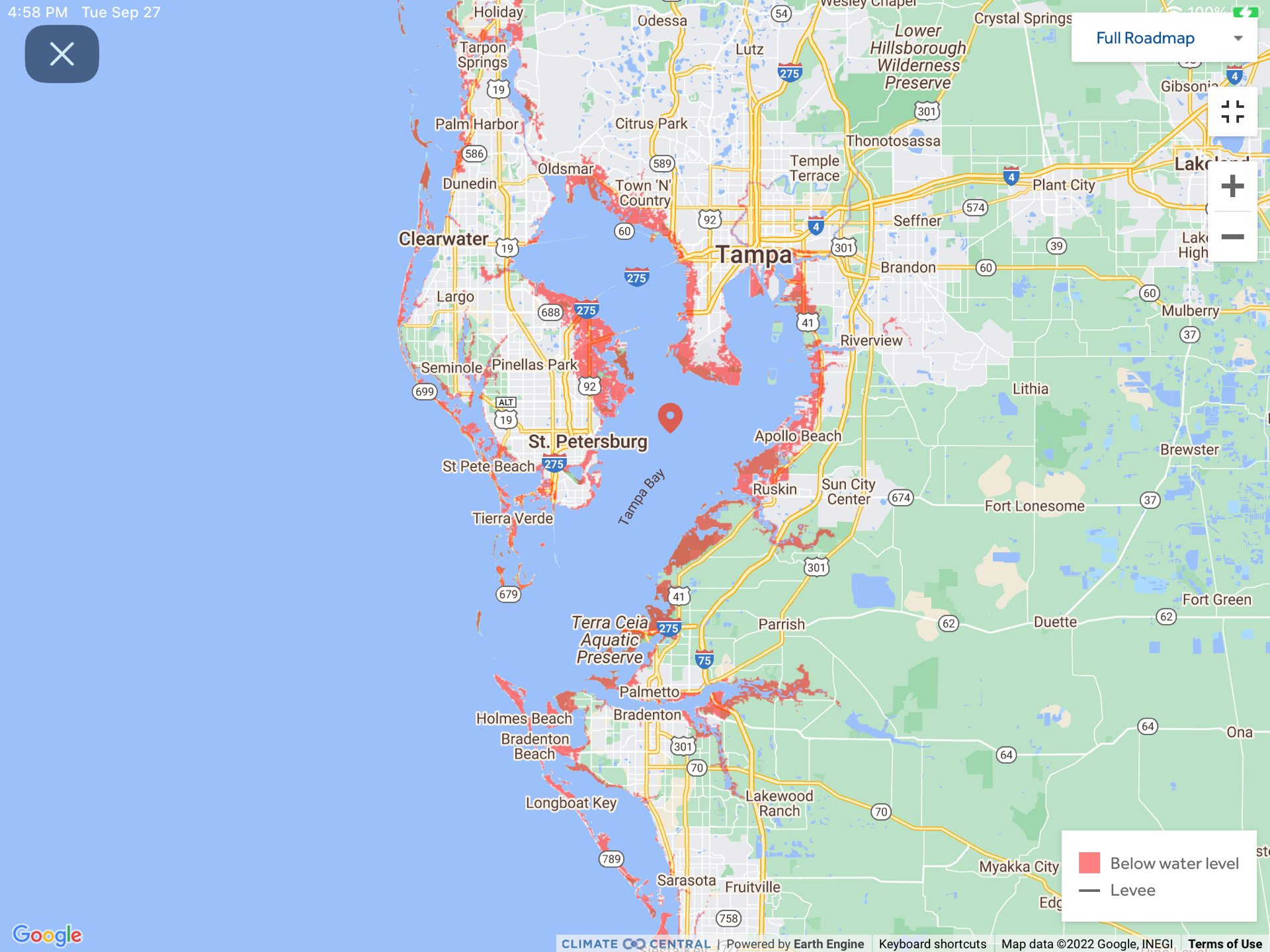
Here are the 3, 6, and 9 foot flood levels for the Tampa and St. Petersburg Florida area, although the latest NOAA shows only 4-6 feet for this area., but there is a 2.5 foot high tide as well about 2pm Wednesday.

For the Charlotte Harbor, Boca Grande, Fort Myers area, for the 12-18 foot prediction, we show flood levels at 3, 6, 9, 12, and 15 feet. On Wednesday, at Punta Gouda, the high tide is at 5:57 pm at 1.7 feet. On Thursday morning, it is at 4:51 AM at 2.2 feet.

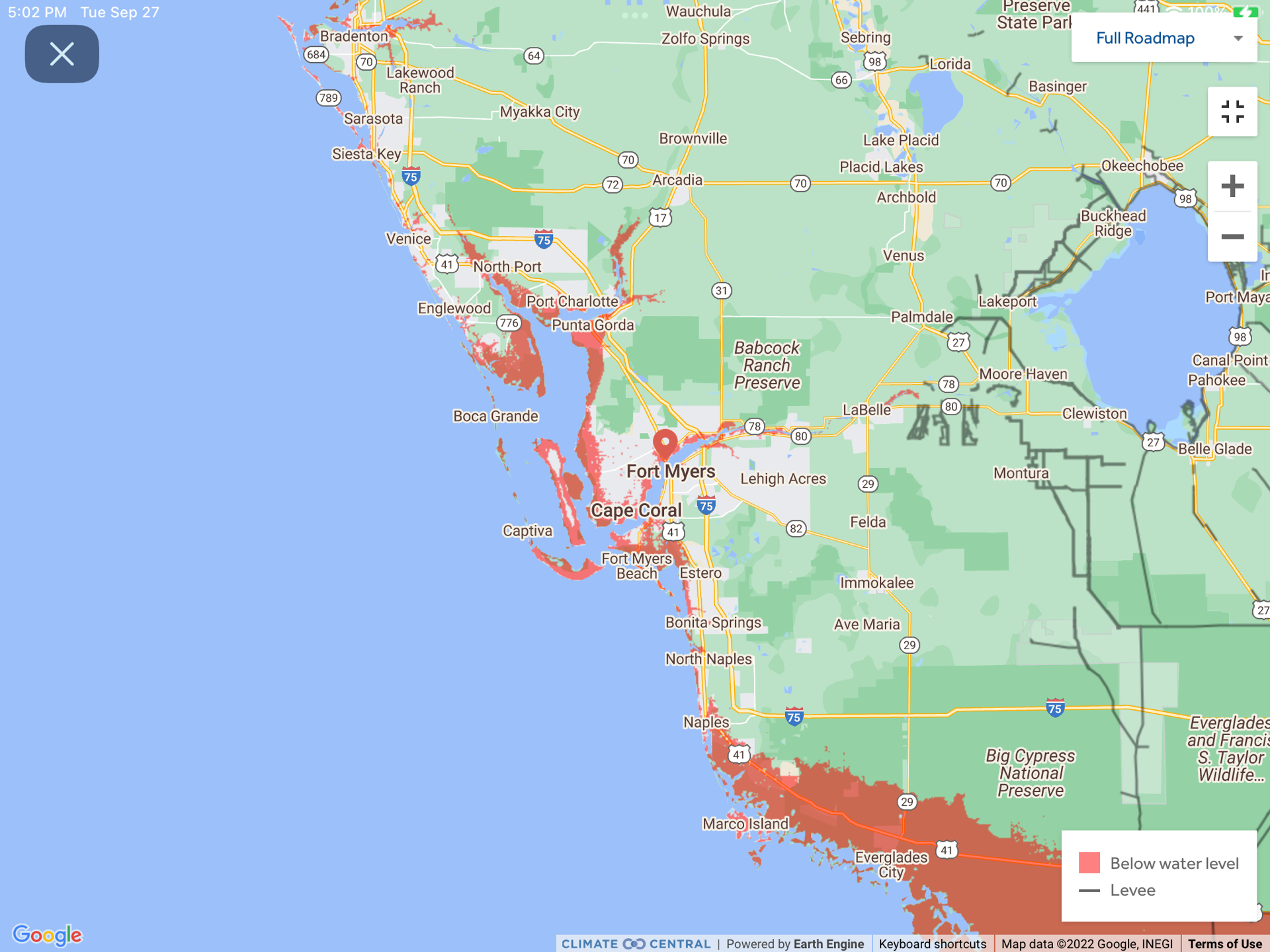
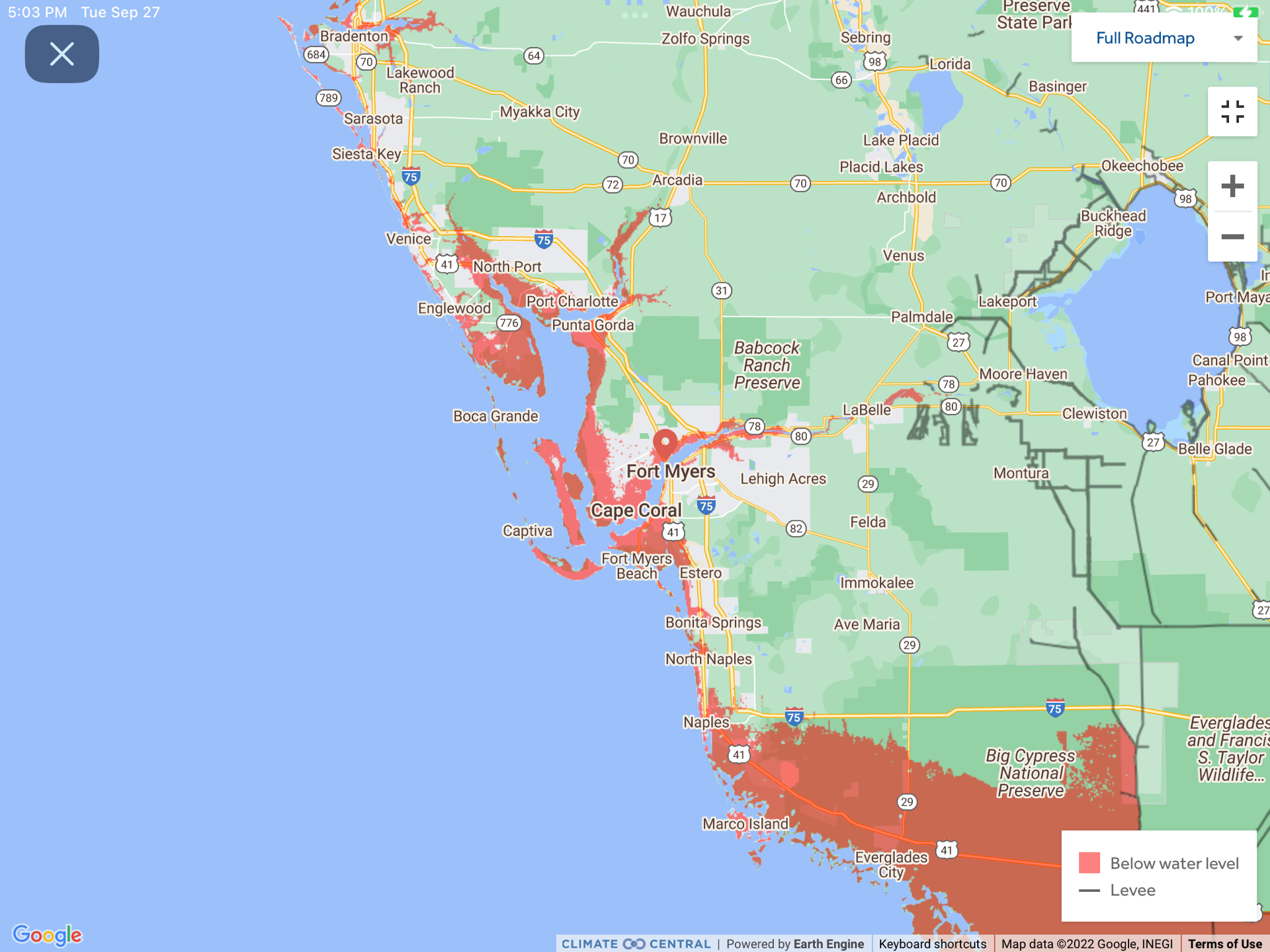
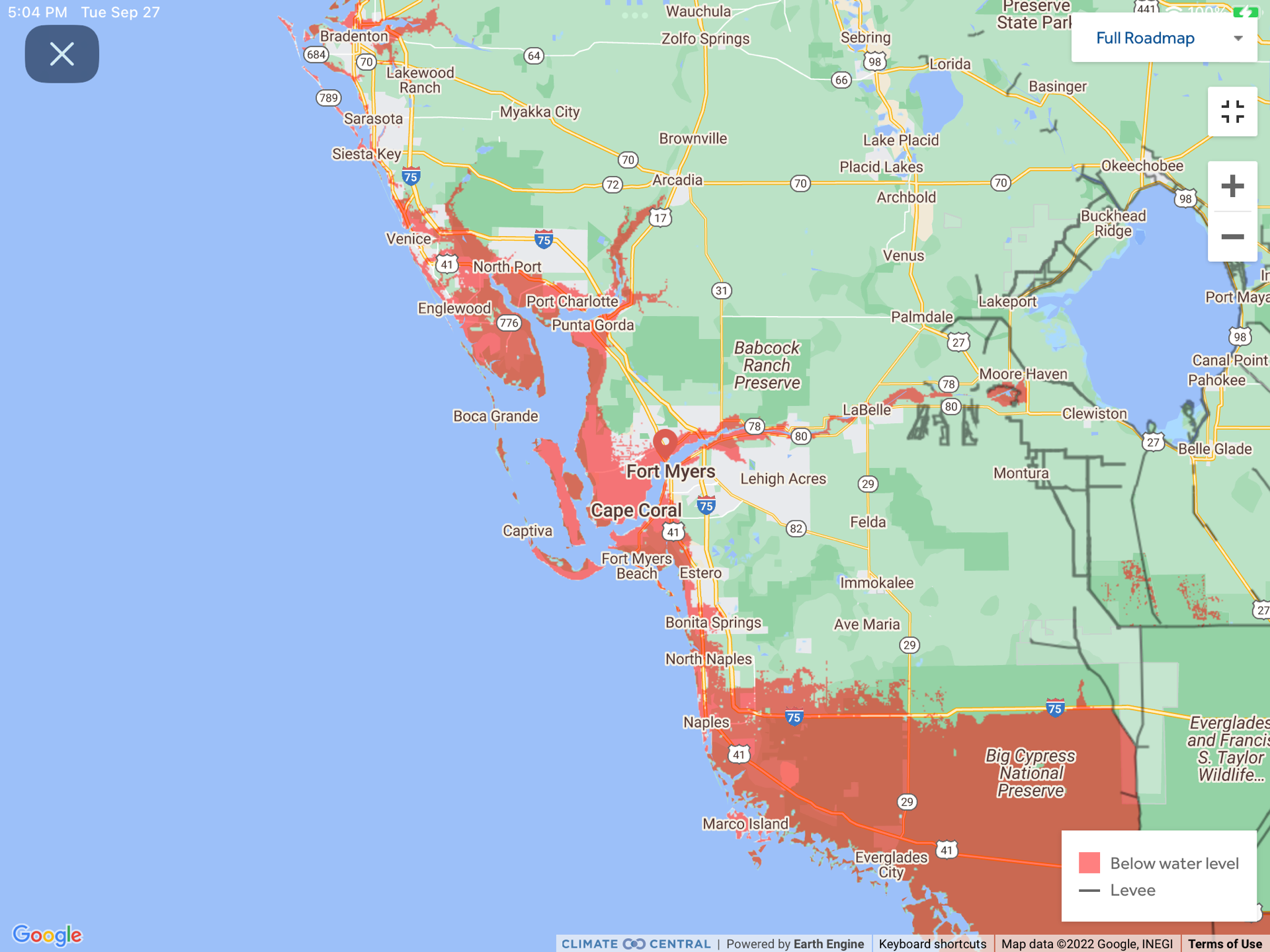

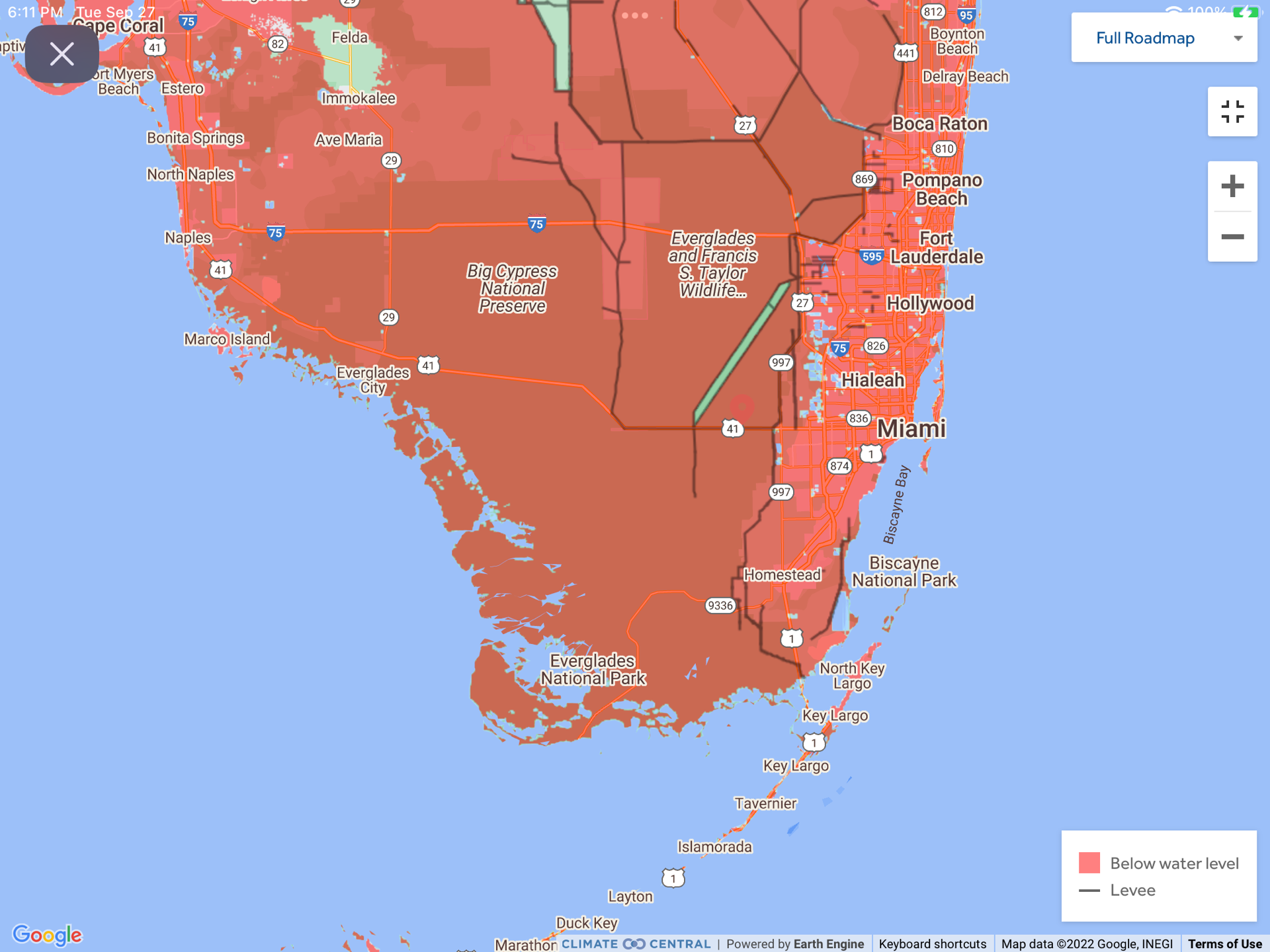
Fortunately, or historically, much of the flooded areas are already nature preserves.
Here is a close-up of Fort Myers if it gets to 15 feet.

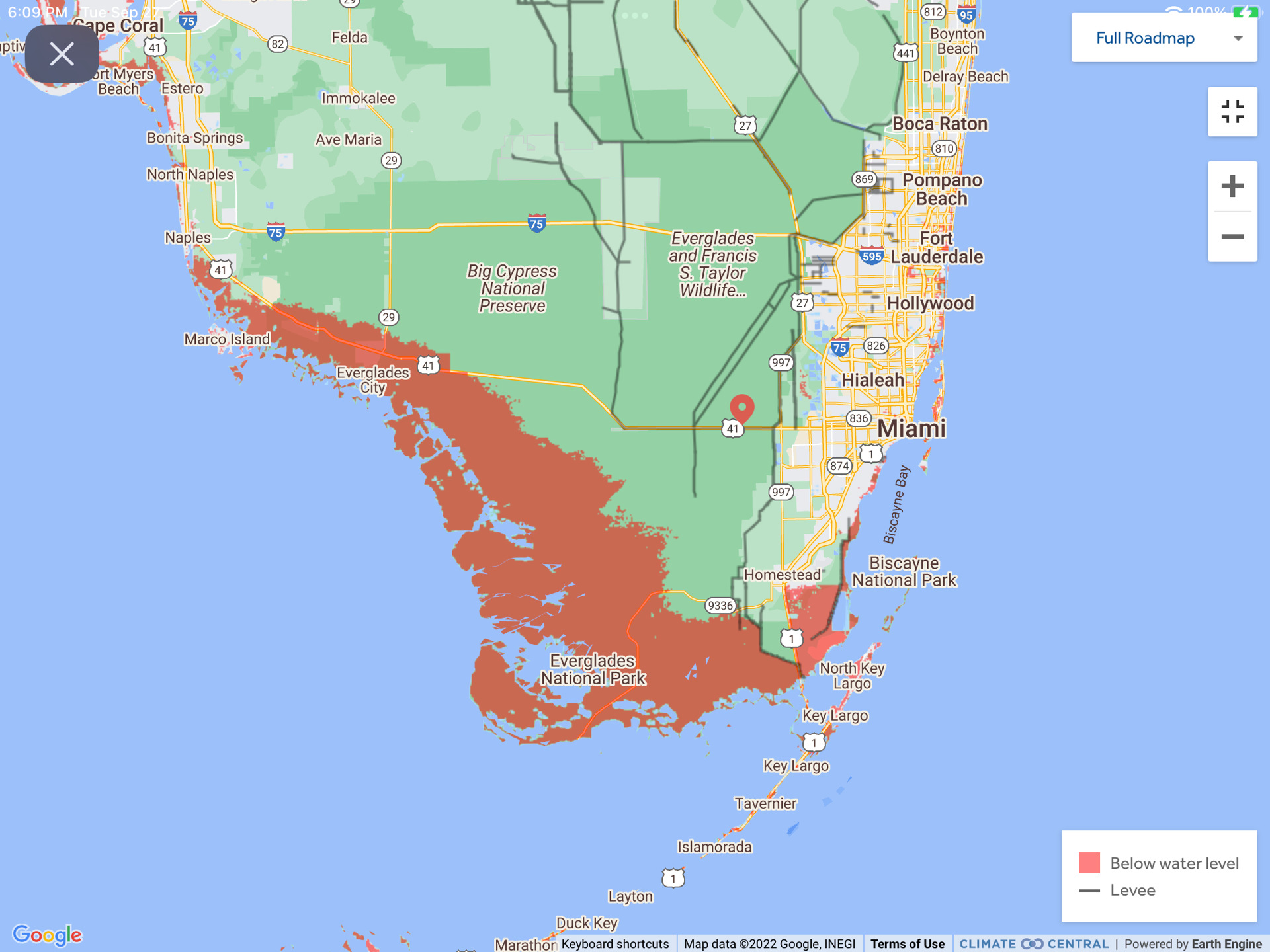
The southern Everglades are listed as 4-6 feet. We give the flood maps for 3, 6, and 9 feet. The black lines are levees that protect East Florida from the Everglades.

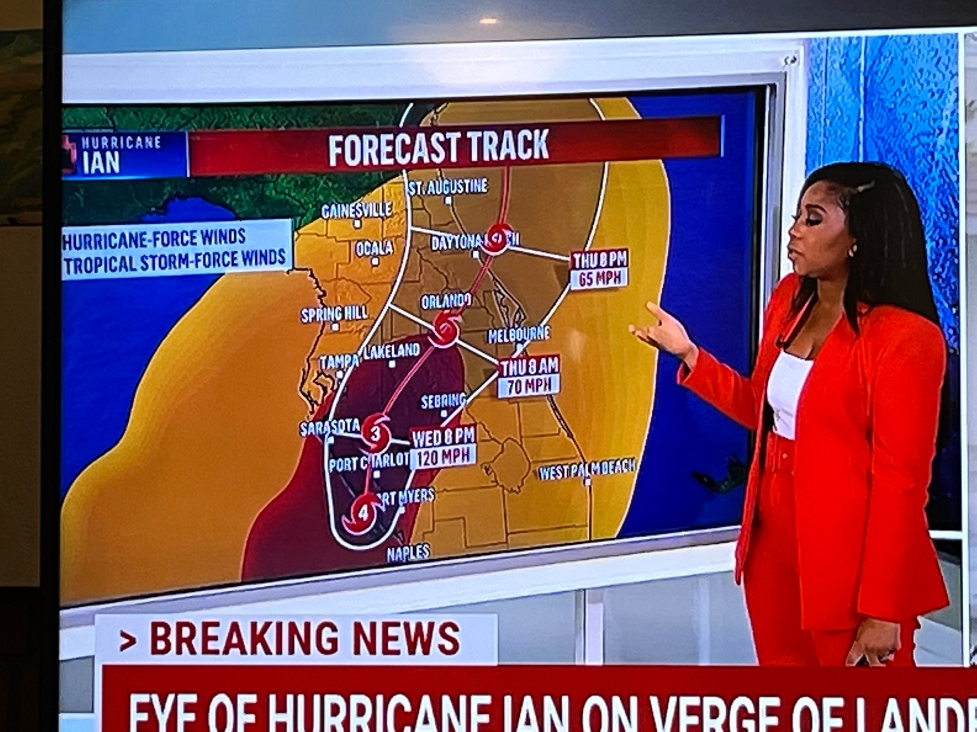
Here are more Ian storm projections as of 3 PM EST Wednesday.