We use US flood maps from Climate Central at coastal.climatecentral.org.
Here are the predicted range of flood heights along the shores of Georgia, and South and North Carolinas.
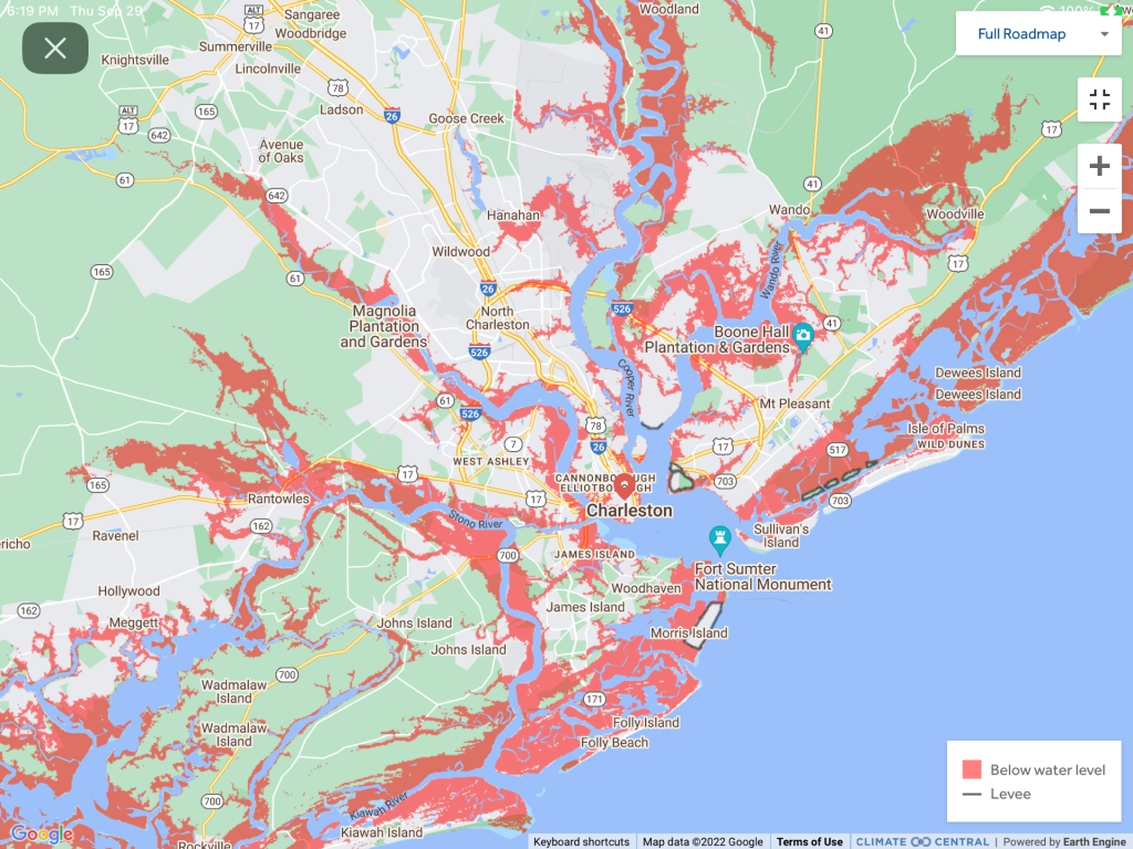
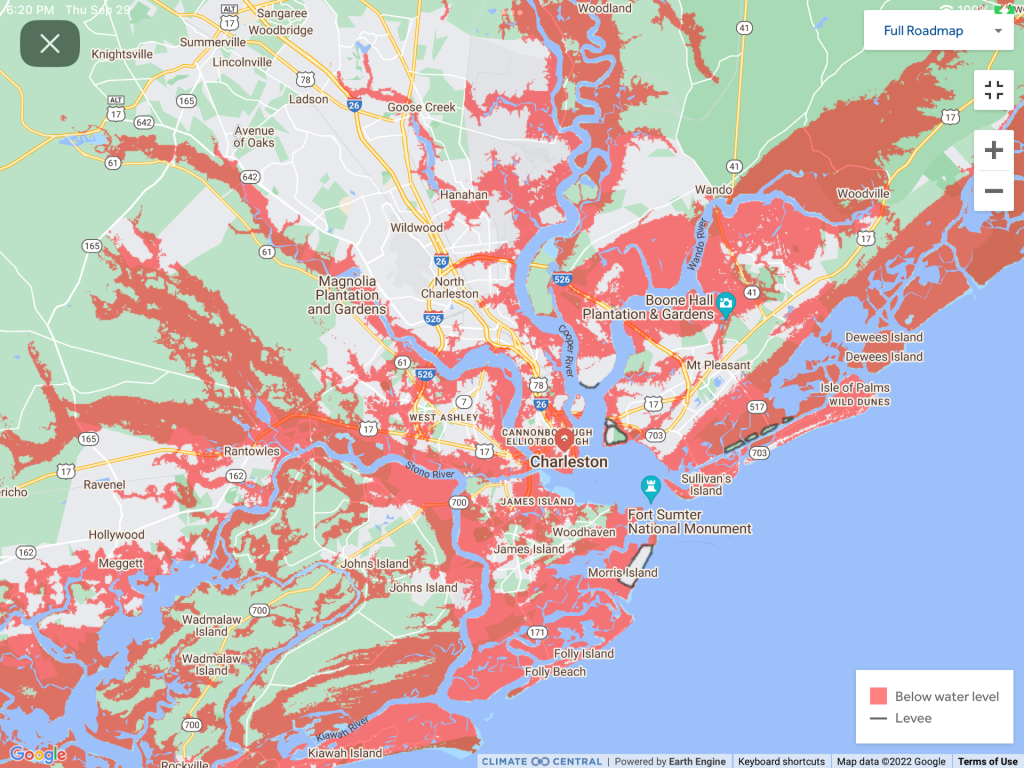
With a predicted storm surge of from 4-7 feet, here are the 3, 5, and 7 foot level flood height inundation maps around Charleston, South Carolina. Fortunately, hurricane Ian warnings are up to 7 AM on Friday, September 30, and there is a low tide of only 0.5 feet at 5:20 AM. The next high tide will be at 6.3 feet at 11:41 AM after the low. A lot of the flooded parts by the ocean are already unoccupied tidal lands.
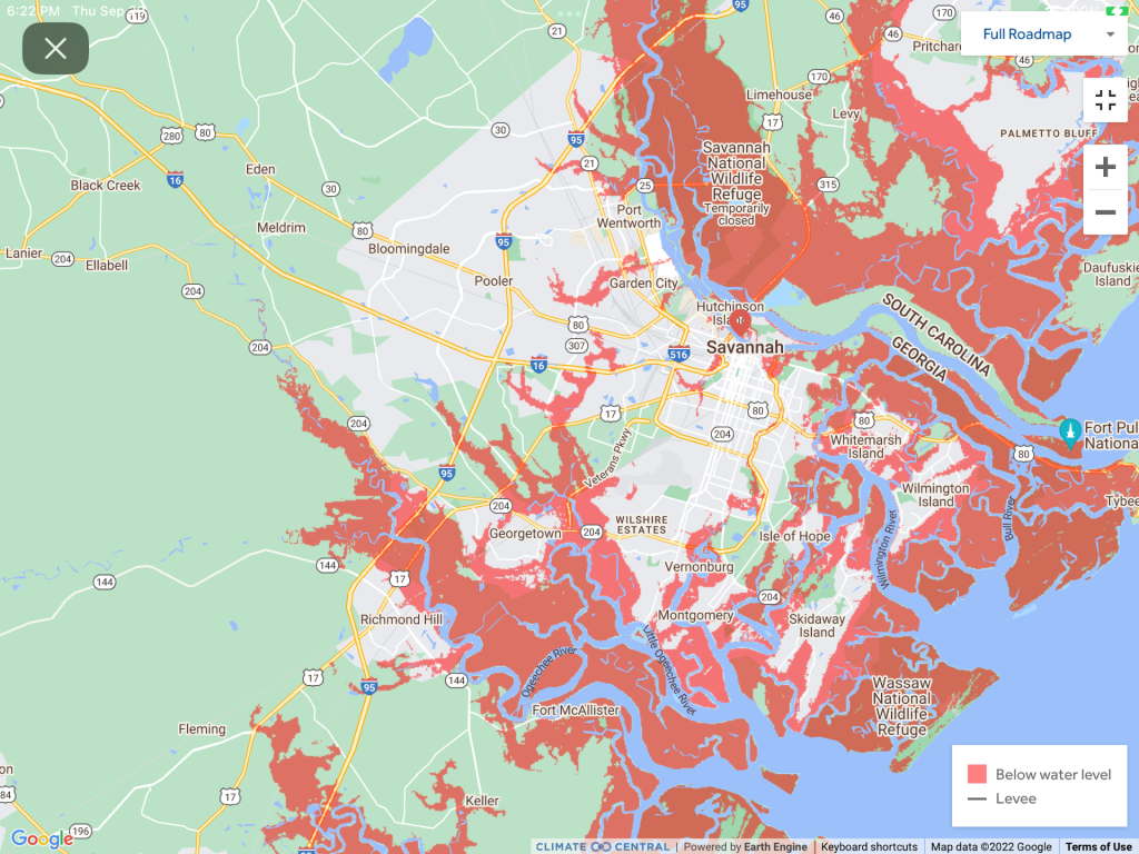
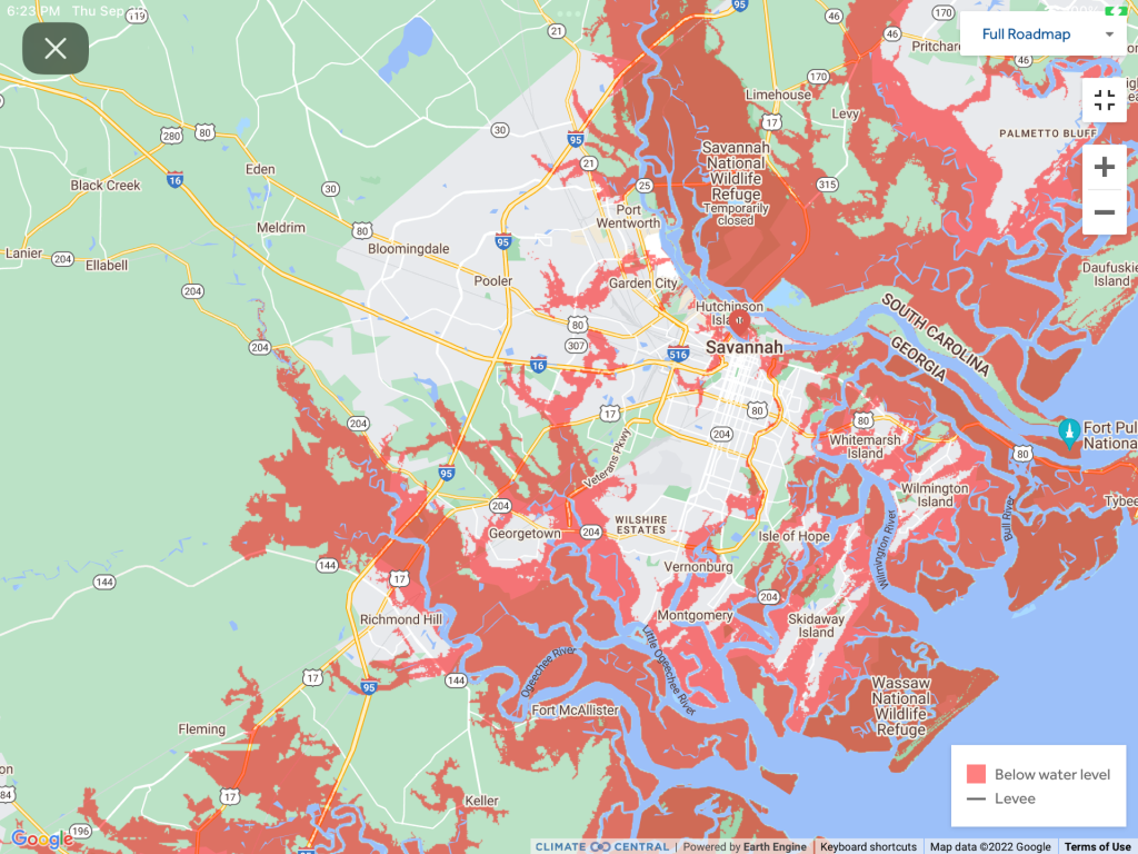
With a predicted storm surge of 4-6 feet for Savannah, Georgia, here are the 3, 5, and 7 foot flood levels for Savannah. The latest Hurricane Ian track now points further north than Savannah towards Charleston. The next low tide is at 6:25 AM on September 30 of only 0.6 feet. The high tide after that is 9.2 feet at 12:22 PM. A large part of the flooded area are tidal flats.


