Thursday, June 8, the Wildfire Smoke Moves South, to Washington, D.C.
Links are in the previous article, and at 3 PM EST this shows the PM 2.5 pollution contours and the color code of Unhealthy for All in the Red.

This shows the prediction for tomorrow, June 9th, of Ozone plus PM Air Quality Index.

This shows the PM 2.5 contours and monitors for June 8th, at 4 PM, EST.

This shows the air currents at 3 PM EST on June 8.

This shows the Western, Southern and then Eastward smoke movement from the fires in Canada at the tiny flame sites at 3PM EST, June 8.

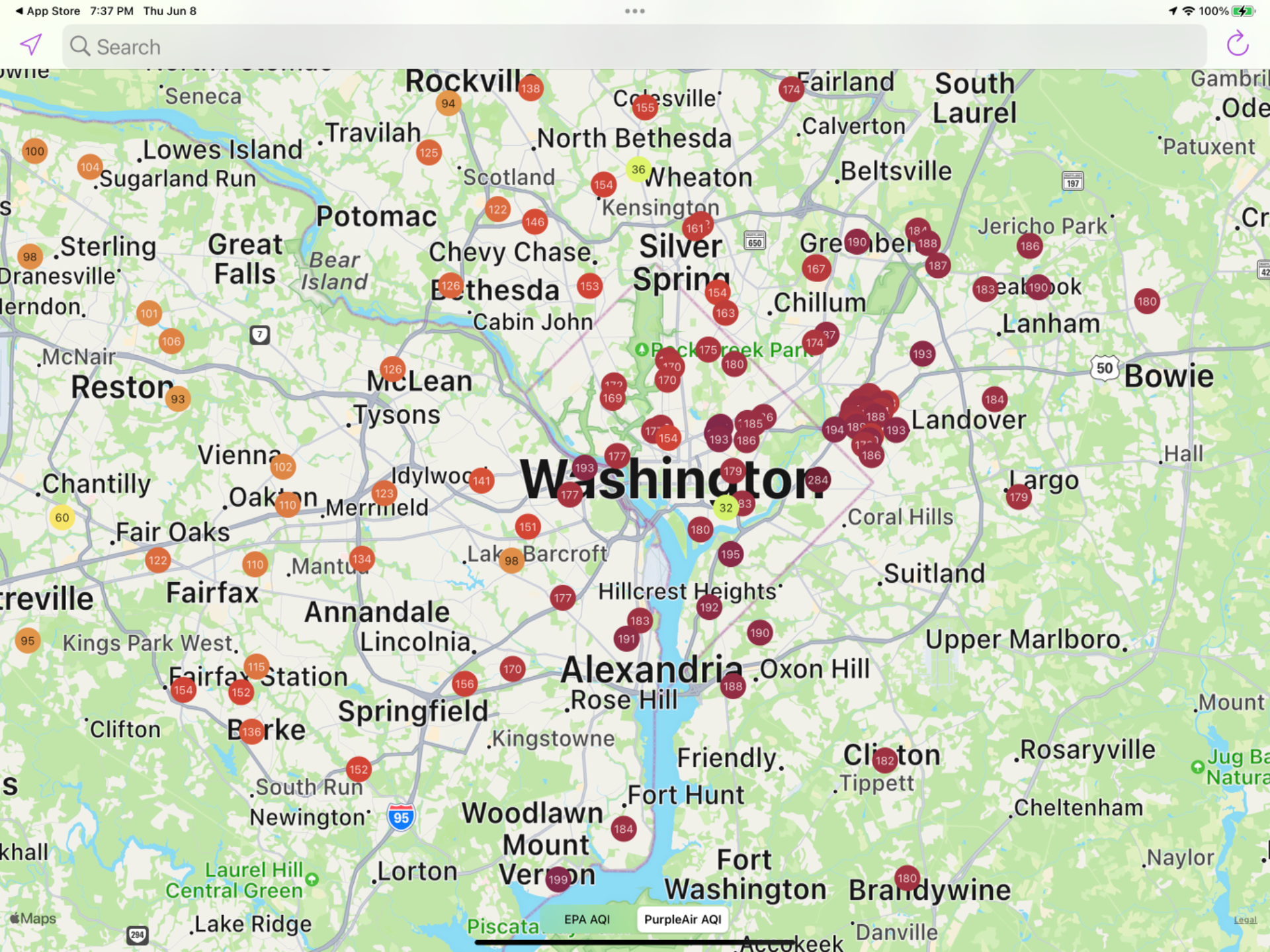
This map gives the PM 2.5 readings from PurpleAir sites at 3:30 PM, June 8. Philadelphia had reached a high of 444 this morning.

Caution: a single, exceptionally high reading in a quieter zone may be due to a local pollution source.
This is PM 2.5 around Washington, D.C. at 10:30 PM, June 8.
This is a map of the Eastern wildfires in Canada at 10:30 PM, EST on June 8.

To be proper, the fires are wildfires in Canada, not Canadian wildfires. There are 600 American firemen aiding in fighting them.